TIL BDR GHALLEY | Thimphu
Deadly glacier-related flooding in Nepal has renewed attention on Bhutan’s preparedness for glacial lake outburst floods (GLOFs), particularly in the Lunana region, where several high-altitude lakes and glaciers have been monitored for decades.
The disaster in Nepal’s Rasuwa district on August 26, triggered by a glacier collapse and ice avalanche, sent debris and floodwaters downstream and led to the formation of lakes upstream. Authorities have continued monitoring the area for the risk of further flooding.
For Bhutan, the incident highlights the wider range of hazards that can develop rapidly in the high Himalayas, where glacier collapse, avalanches, landslides, debris flows and glacial lake outbursts can interact and threaten communities and infrastructure downstream.
Bhutan has experienced major GLOF events in 1957, 1960, 1968 and 1994, according to the National Centre for Hydrology and Meteorology (NCHM).
The most devastating recent event occurred on October 7, 1994, when Luggye Tsho in Lunana breached. NCHM records show that 21 people were killed, 91 houses were damaged and 1,781 acres of land were affected. The flood also caused partial damage to Punakha Dzong.
The 1994 disaster originated from Luggye Tsho, rather than Thorthormi or Raphstreng. However, the event demonstrated how a major outburst originating in the high-altitude Lunana region can affect settlements and infrastructure far downstream.
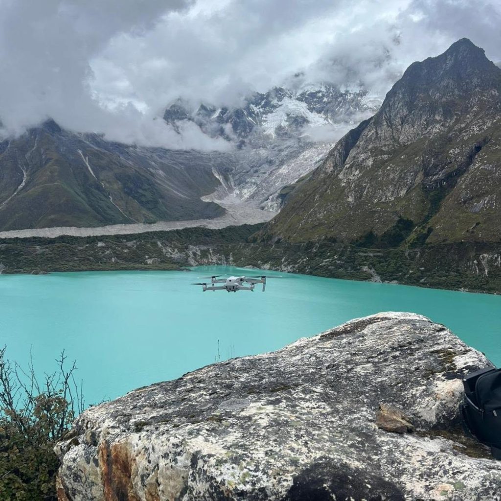
Thorthormi and Raphstreng are located in the upper Pho Chhu basin, which drains towards Punakha. Both lakes, along with their surrounding glaciers and moraine structures, have been subject to technical studies and monitoring because of changes in the high-altitude environment.
An assessment by the Geological Survey of Bhutan and Geological Survey of India in 1986 recommended periodic monitoring of the Raphstreng-Thorthormi system.
An Austrian-Bhutanese project conducted between 1999 and 2002 subsequently examined the Thorthormi Glacier and its expanding proglacial lake.
The risk posed by rapidly changing conditions became particularly evident in June 2019, when an NCHM monitoring station detected a sudden rise in Thorthormi’s water level from 6.55 metres to 8.04 metres in about 25 minutes.
The increase triggered an alert in the GLOF early-warning system covering the Punakha-Wangdue valley.
NCHM personnel who travelled to Lunana found that Subsidiary Lake II of Thorthormi had breached and almost completely drained. The following day, they observed a partial breach at the main Thorthormi Lake, creating a new outlet.
A subsequent NCHM assessment found renewed sliding along the moraine separating Thorthormi and Raphstreng. The narrowest section of the barrier was measured at 33.5 metres, and the possibility of Thorthormi breaching towards Raphstreng was identified as a significant concern at the time.
A mitigation project carried out between 2008 and 2012 lowered the main lake’s water level by five metres, according to NCHM.
The agency subsequently recorded further reductions following events in 2019 and 2023.
In 2025, NCHM tested a natural siphon system as an additional method of lowering the lake. The pilot siphon was constructed but failed to achieve sustained flow, prompting the agency to recommend a second trial at another location.
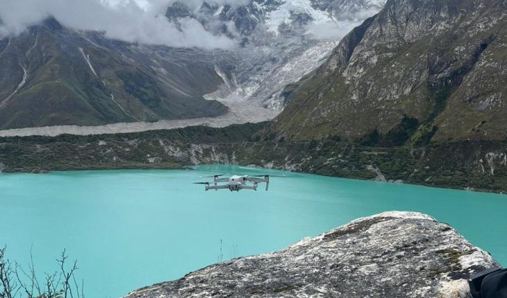
NCHM also attempted to update Thorthormi’s bathymetry during fieldwork in 2025.
The survey recorded a maximum depth of 326 metres in the portion measured, although the full depth range of the lake could not be surveyed.
The difficulties encountered during the survey underscore the challenges of conducting detailed assessments in Bhutan’s remote and rapidly changing high-altitude environment.
The country established a GLOF early-warning system for the Punatsangchhu basin in 2011. NCHM monitors hydrological conditions in real time and maintains systems intended to provide warnings to downstream areas when abnormal conditions are detected.
NCHM’s 2023 assessment identified the need to upgrade and rehabilitate the existing early-warning system, citing its age, maintenance difficulties and outdated technology.
The assessment also recommended additional monitoring equipment, including seismic and visual sensors, to improve hazard detection and provide more warning time.
For communities downstream, the effectiveness of an early-warning system depends not only on detecting an event but also on how quickly the information reaches people at risk and whether evacuation measures can be implemented in time.
The latest Bhutan Glacial Lake Inventory, published by NCHM in 2026, records 620 glacial lakes across the country, compared with 567 in the 2021 inventory.
The Pho Chhu sub-basin recorded the largest increase, rising from 157 lakes in 2021 to 187 in the latest inventory.
Among the country’s 17 potentially dangerous glacial lakes, three — Thorthormi, Raphstreng and Luggye Tsho — are located in the Pho Chhu basin, according to NCHM.
However, classification as a potentially dangerous glacial lake does not mean that a lake is currently on the verge of breaching.
The designation indicates the need for continued assessment and monitoring. Determining the actual level and nature of the hazard requires lake-specific studies that consider factors such as lake volume, moraine stability, surrounding glaciers, possible triggers and downstream exposure.
This distinction is particularly important when discussing Thorthormi and Raphstreng.
Neither lake was responsible for the 1994 GLOF. That disaster originated at Luggye Tsho.
The recent disaster in Nepal also illustrates why GLOF preparedness cannot focus exclusively on lakes.
In high mountain environments, a glacier collapse or ice avalanche can block a river, create a temporary lake or generate a destructive debris flow without following the conventional pattern of a glacial lake gradually filling and breaching.
Rockfalls, landslides, avalanches and glacier-related events can occur in combination, making hazard assessment increasingly complex.
For Bhutan, this means monitoring needs to extend beyond lake water levels to the glaciers, moraine dams, surrounding slopes and river systems that could influence downstream flooding.
The country has already invested in lake-level reduction, early-warning systems, field monitoring and technical assessments.
But the changing Himalayan environment means that preparedness cannot be treated as a one-time intervention.
The experience at Thorthormi, including the 2019 lake-level surge and subsequent monitoring, demonstrates the need for continuous observation. The difficulties in completing the 2025 bathymetric survey also show the practical challenges of obtaining complete information from remote glacial environments.
The 1994 Luggye Tsho disaster remains a stark reminder of the consequences a major GLOF from Lunana can have downstream.
Thorthormi and Raphstreng were not responsible for that event, but their location in the upper Pho Chhu basin, their changing physical environment and their classification among Bhutan’s potentially dangerous glacial lakes keep them central to the country’s efforts to understand and manage future glacial hazards.
The lesson from Nepal is therefore not simply that Bhutan faces another possible GLOF.
It is that Himalayan hazards are evolving, sometimes rapidly, and preparedness must evolve with them.